
Cyclone Biparjoy won't hit Karachi, starts impacting coastal areas
KARACHI (92 News) - Gusty winds have struck Karachi, Thatta, Badin and Sajawal as cyclone Biparjoy started affecting the coastal areas on Wednesday.
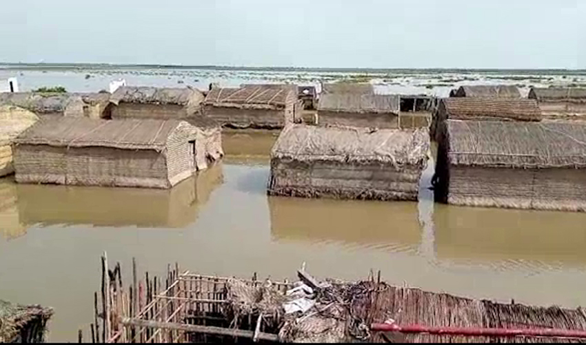
Roofs of several houses were blown and high-transmission poles collapsed in coastal areas of Thatta. Water entered in villages, including Muhammad Ali Sholani, Siddique Sholani and Isa Rajero due to flood in the sea. Water started hitting the National Highway near Garho Creek.
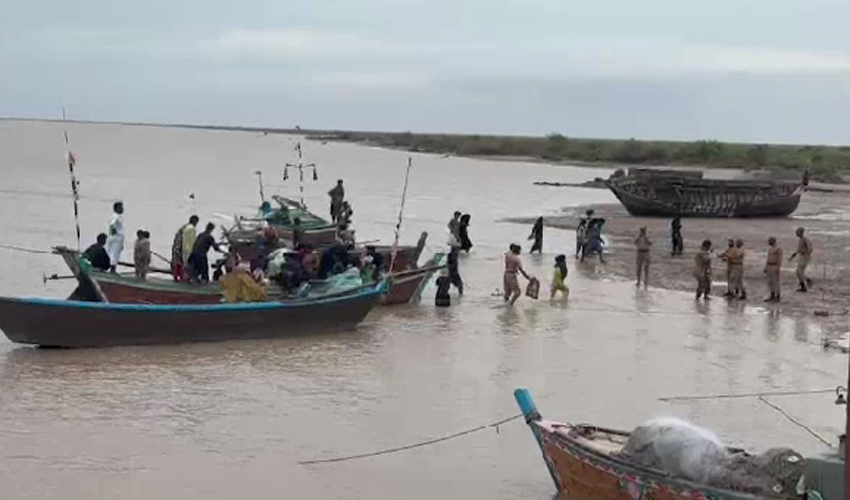
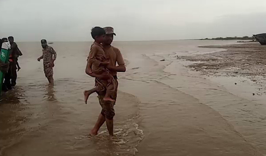
The authorities declared high alert in Badin and localities adjacent to Zero Point were evacuated. In all, 65,000 people have been shifted to safer places from the coastal areas so far. Teams of the Pak Army, Rangers, Pak Navy and Marine Security are busy in the rescue operation.
According to the Met Office, the Very Severe Cyclonic Storm (VSCS) 'Biparjoy' over northeast Arabian Sea moved north-northeastward during last six hours, and now lies near Latitude 21.7°N and Longitude 66.4°E at a distance of about 370km south- southwest of Karachi, 355km south- southwest Thatta and 290km south- southwest of Keti Bandar. There is no threat of it striking the city.
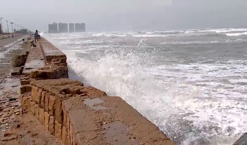
Maximum sustained surface winds are 150-160 km/hour gusts 180 km/hour around the system center and sea conditions being phenomenal around the system center with maximum wave height 30 feet.
The favourable environmental conditions (sea surface temperature of 29-30°C, low vertical wind shear and upper-level divergence) are in support to sustain its strength through the forecast period. Under the existing upper-level steering winds, the Biparjoy started to re-curve north-northeastward and likely cross between Keti Bandar (southeast Sindh) and Indian Gujarat coast on June 15 evening as a Very Severe Cyclonic Storm (VSCS) with packing winds of 100-120 Km/hour gusting 140 km/hour.
Possible impacts:
- With its probable approach to the southeast Sindh coast, widespread wind-dust/thunderstorm rain with some very heavy/extremely heavy falls accompanied with squally winds of 80-100km/hour gusting 120km/hour likely in Thatta, Sujawal, Badin, Tharparker, Mirpurkhas and Umerkot districts during June 14-17.
- Dust/thunderstorm-rain with few heavy falls and accompanied with squally winds of 60-80 km/hour likely in Karachi, Hyderabad, Tando Muhammad Khan, Tando Allayar, Shaheed Benazirabad and Sanghar districts from June 14-16.
- Dust/thunderstorm-rain with isolated heavy falls likely in Hub, Lasbella districts of Balochistan during June 14-16.
- Squally (high intensity) winds may cause damage to loose and vulnerable structures (Kutcha houses) including solar panels etc. Storm surge of 3-3.5 meters (8-12 feet) expected at the land falling point (Keti Bandar and around) which can inundate the low-lying settlements.
- Sea conditions along Sindh coast may get very rough/ high (2-2.5 meter) and rough/ very rough (2 meter) along Balochistan coast (Sonmiani, Hub, Kund Malir. Ormara and surroundings).
- Fishermen are advised not to venture in open sea till the system is over by June 17.